Beaver Lake State Park's non-motorized trail system covers 5.4 miles in a series of loops and several connecting segment trails that are open for hiking and biking. The Beaver Lake Nature Trail is a self-guided nature trail open to hiking only. Most of the trail system surface is either grass, dirt or hard-packed single-track, with manageable grades with only a few steeper sections.
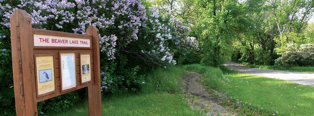
Beaver Lake Nature Trail
Distance: 0.3 miles
Open to: hiking
This self-guided interpretive trail begins and ends at the swimming area. The nature trail winds through woodlands, skirts the lake shoreline and meanders through the rolling prairie.
Old Settlers Trails
Distance: 0.5 miles
Open to: hiking, mountain biking
This trail starts just south of the amphitheater and winds its way along the lake shoreline, passing the tent campground, park cabins, picnic area and shelters coming to an end just north of the park entrance. The trail provides scenic overlooks of the lake. The stone cairn bearing an inscription naming the park founders and park dedication date of July 24, 1932, can be seen from the trail. In addition, from the trail one can glimpse the old stone cabin, which was used by the park caretaker as a residence.
Woodland Trail
Distance: 0.8 miles
Open to: hiking, mountain biking
Starting south of the west campground comfort station, this biking/hiking trail meanders in and out of grasslands and woodland areas providing habitat for a variety of bird species. Common summer bird species to look for include kingbirds, meadowlarks, woodpeckers, chickadees, and yellow warblers.
Moraine Loop Trail
Distance: 2.3 miles
Open to: hiking, mountain biking
This trail starts at the trailhead just south of the entrance road, loops through native prairie, then meets the Lake View Trail at a signed junction. Hikers can easily see the shape of the landscape carved out by a glacier as they travel up and over the rocky moraine. The trail offers some excellent views of Beaver Lake and provides good bird and butterfly watching opportunities.
Lake View Loop Trail
Distance: 0.4 miles
Open to: hiking, mountain biking
The short trail is located between the Moraine Loop and Rolling Prairie Loop in the southern portion of the park. Access can only be gained by traveling along the Moraine Loop. A short trail segment provides a link from the Lake View Trail to the southernmost, secluded Rolling Prairie Loop Trail. The trail skirts several green ash-American elm woody draws that provide important food and cover for game and non-game species such as birds, beaver, raccoons, rabbits, deer, and squirrels.
Rolling Prairie Loop Trail
Distance: 1.1 miles
Open to: hiking, mountain biking
This 1.1-mile biking-hiking trail explores rolling prairie and wooded ravines in the most secluded area of the park. The scenic trail displays an array of prairie wildflowers and native grasses. Prairie wildflowers include Missouri goldenrod, scarlet gaura, silver scurfpea, vetch, white milkwort, yellow coneflower, and leadplant. Common prairie grasses include western wheatgrass, big bluestem, little bluestem, green needle grass, needle-and-thread grass, porcupine grass and prairie junegrass.
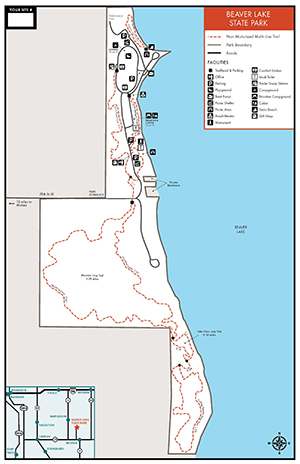
Trail Maps:
- A PDF Map of the trails is available here.
- All North Dakota State Park and Recreation Area trail information is available on the OuterSpatial App.
- Paper park maps are also available at the park.