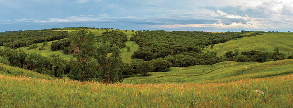
Fort Ransom State Park’s non-motorized trail system covers over 20 miles in a series of loops, trails and connecting segment trails most which are multi-use and are open for hiking, horseback riding, biking, cross-country skiing and snowshoeing. The majority of the trail system surface is either grass, dirt or hard-packed single-track, with manageable grades with only a few steeper sections.
North Country National Scenic Trail (NC)
Distance: 2.2 miles
Open to: hiking, snowshoeing, mountain biking, horseback riding
When completed this trail will stretch 4,600 miles from upstate New York to Lake Sakakawea State Park, where it joins the Lewis and Clark National Historic Trail. The 2.2-mile trail segment provides an excellent vantage point for viewing the park's native plants and animals as it stretches from the south to the northeast boundary of the park, along the Sheyenne River.
Redetzke Ridge Trail (RR)
Distance: 2.84 miles
Open to: hiking, snowshoeing, mountain biking, horseback riding
A 2.84-mile multi-use, non-motorized trail. The trail stretches from the Redetzke Ridge Trailhead just east of the Group Picnic Area picnic shelter to the Sunne Farm Trailhead, where it links with the North County National Scenic Trail. The trail with gentle inclines and descents winds in a north-south direction traversing through and around oak woodlands and mixed-grass prairie providing excellent opportunities to view both prairie and woodlands bird species such as clay-colored and vesper sparrows, Swainson’s and red-tailed hawks, Cooper’s hawk, black-capped chickadee, white-breasted nuthatches and bobolinks.
Pederson Hills Trail (PH)
Distance: 1.36 miles
Open to: hiking, snowshoeing, mountain biking, horseback riding
This trail begins at the trailhead just southwest of the West Side Modern Campground. The trail gently climbs northward through oak woodlands and mixed-grass prairie eventually intersecting the Ridgeline Nature Trail.
Spur Trail (S)
Distance: .39 miles
Open to: hiking, snowshoeing, mountain biking, horseback riding
A .39-mile gently meandering trail that connects Pederson Hills Trail and Ridgeline Trail providing a shortcut to the Group Picnic Area.
North Fork Trail (NF)
Distance: 1.64 miles
Open to: hiking, snowshoeing, mountain biking, horseback riding
The trail begins its travels north alongside oak woodlands, paralleling Bjorn Creek, an intermittent stream, climbing gradually to the North plateau. The trail winds back south to intersect the Snowmobile Trail ending at the Scenic Overlook parking lot. Portions of this trail transverse some very diverse lowland woodlands and adjacent to some rather steep native prairie slopes dominated by big bluestem grasses.
Nelson 80 (N80)
Distance: 1.28 miles
Open to: hiking, snowshoeing, mountain biking, horseback riding
The outbound segment travels through a dense woodland canopy dominated by bur oaks and ironwood. Sections of the trail follow the west fork of the Bjorn Creek drainage. The return segment follows the south park boundary fence line.
Firebreak Trail (FB)
Distance: .86 miles
Open to: hiking, snowshoeing, mountain biking, horseback riding
This trail skirts along the large oak woodland. The trail serves as a fire break for controlled burns, reducing the risk of fire from sweeping up the slope into the woodlands.
Little Twig Nature Trail (LT)
Distance: .94 miles
Open to: hiking, cross-country skiing, snowshoeing, mountain biking, horseback riding
A .94-mile interpretive trail which takes you through a lowland woodland community dominated by green ash and American elm; twists and turns through oak woodlands; and meanders through meadows. There are several wooden walk bridges that cross the Bjorn Creek. The trail contains several numbered posts and a corresponding trail guide describing geology, plant and wildlife in the area. Trail guides are available at the trailhead and Visitor Center. Keep a watchful eye for the long tailed, brown and gray, secretive black-billed cuckoo which is more often heard than seen. Listen for its “cu-cu-cu-cu-cu-cu-cu-cu”. The Eastern wood pewee is another woodland bird that would be overlooked if not for its persistent “pee-ah-wee” song.
Ridgeline Nature Trail (RL)
Distance: .77 miles
Open to: hiking, snowshoeing, mountain biking, horseback riding,
A .77-mile interpretive trail that branches off the Little Twig Trail and ends just west of the Group Picnic Shelter. It winds its way under a canopy of bur oak, green ash, quaking aspen and ironwood. Portions of the trail take you through mixed grass prairie. The trail contains several numbered posts and a corresponding trail guide describing trees and shrubs of the area. Trail guides are available at the trailhead and Visitor Center. This trail is a good place to observe Cooper’s hawks, wild turkeys, scarlet tanagers and indigo buntings. There is one steep climb on this trail.
Valley View Trail (VV)
Distance: .78 miles
Open to: hiking, snowshoeing, mountain biking, horseback riding
A .78 mile multi-use trail that starts at the Scenic Overlook parking lot and goes to the Sunne Farm. The short trail crosses an old field and curves along native prairie slopes providing a pleasant overlook of the Sheyenne River Valley. On the prairie slopes you may find little bluestem, big bluestem, green needlegrass, porcupine grass and side-oats grama. Some of the more common native flowers include prairie coneflower and purple coneflower.
Oak Ridge Trail (OR)
Distance: .23 miles
Open to: hiking, cross-country skiing, snowshoeing, mountain biking, horseback riding
A .23-mile trail connecting Ridgeline Nature and Meadow Run Trails. This trail is an excellent choice for those hikers and bikers wishing for a shorter, but diverse trail loop adventure. Access to this trail is via the Ridgeline Nature Trail.
Meadow Run Trail (MR)
Distance: .33 miles
Open to: hiking, cross-country skiing, snowshoeing, mountain biking, horseback riding
Access to this .33-mile trail is via the Ridgeline Nature Trail and eventually connects back to the Little Twig Trail. The majority of the trail runs through open grassland bordered by oak woodlands and stands of aspen. The open meadows the trail passes through, provide excellent nesting and rearing habitat for white-tailed deer, rabbits, and turkeys.
Riverside Trail (R)
Distance: .25 miles
Open to: hiking, cross-country skiing, snowshoeing, mountain biking
This .25 mile trail is one of the few trails in the park that takes you into the diverse lowland woodland and floodplain forest along the Sheyenne River. Horseback riding is prohibited on this trail. The trail zigzags through towering basswood, American elm, green ash and boxelder trees. These woodlands provide a high diversity of woodland forbs including Solomon’s seal, moonseed, and Enchanter’s nightshade
Southgate Trail (SG)
Distance: .41 miles
Open to: hiking, snowshoeing, mountain biking
This .41 mile trails runs south of the campground and around the amphitheater. Horseback riding is prohibited on this trail.
Willow Slough Trail (WS)
Distance: .72 miles
Open to: hiking, snowshoeing, mountain biking, horseback riding
This trail follows the parks northwest boundary and meanders around Willow Slough.
White Tail Loop Trail
Distance: .46 miles
Open to: hiking, snowshoeing, mountain biking, horseback riding
This trail explores the heavily wooded area with numerous oak and ash trees. As the name states, this area is a favorite hideout for deer.
Trail Maps

- A PDF Map of the trails is available here.
- All North Dakota State Park and Recreation Area trail information is available on the OuterSpatial App.
- Paper park maps are also available at the park.