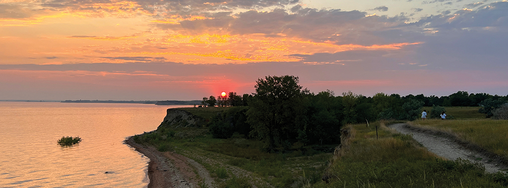
Nearly 10 miles of trails provide hiking, biking and interpretive opportunities in long, linear trail segments and shorter loops. The trail system winds through tree plantings, shrublands, ponderosa pine woodlands, wooded ravines, grasslands and native prairie. Trails follow the lake shoreline and wander over remote portions of the park.
Flicker Loop
Distance: 2.4 miles
Open to: hiking, mountain biking, snowshoeing
Flicker Trail is the park’s longest at 2.4 miles. Its loops and segments stretch from the trailhead just south of the Guard House, up and along the western shoreline, past the Prairie Dog Town and include a one-mile loop just north of the North Loop Campground. The trail meanders through a remnant of native prairie. Common native grasses found in these areas include needle-and-thread, western wheatgrass, blue grama and little bluestem. The trail also skirts tree plantings and a couple of small wooded ravine areas with an overstory of green ash, American elm and box elder. The trail provides the access point to the Northern Pine Loop.
Northern Pine Loop
Distance: 2.1 miles
Open to: hiking, mountain biking, snowshoeing
Northern Pine Loop, 2.1 miles, wanders into the park’s northern portion and is accessed by the Flicker Loop. The trail is secluded amongst the ponderosa pine woodlands. There are spectacular views of the marina and Garrison Bay.
Purple Coneflower Loop
Distance: 1 mile
Open to: hiking, mountain biking, snowshoeing
This trail is one mile and begins at the trailhead just south of the Guardhouse. This southern trail winds through non-native and native grasslands, eventually connecting to the deTrobriand Loop. The trail offers an overlook of deTrobriand Bay.
deTrobriand Loop
Distance: 2 miles
Open to: hiking, mountain biking, cross-country skiing, snowshoeing,
This loop is a 2-mile trail meandering through a variety of habitats including tree plantings, mixed-grass prairie and shrublands. Portions of the trail parallel the eastern shoreline of Lake Sakakawea.
Trooper Challenge Loop
Distance: 0.8 miles
Open to: hiking, mountain biking, cross-country skiing
This 0.8-mile trail, promotes health and fitness, providing a pleasant place to bicycle, walk or run. It also caters to cross country skiers during the winter. The loop offers 16 stations, each with exercise apparatus and posted instructions on how to use the equipment.
Whitetail Loop
Distance: 0.7 miles
Open to: hiking, mountain biking, cross-country skiing
Whitetail loop is 0.7 miles in length and wanders through tree and shrub planting offerings that support a diverse bird population.
Arboretum Loop
Distance: 0.5 miles
Open to: hiking
Arboretum Trail is a double loop about 0.5 miles in length. The trail is an excellent educational experience as it winds through the planting of over 50 species of trees, shrubs, wildflowers and grasses.
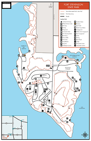
Trail Maps:
- A PDF map of the summer trails is available here.
- A PDF map of the winter trails is available here.
- All North Dakota State Park and Recreation Area trail information is available on the OuterSpatial App.
- Paper park maps are also available at the park.